KET 28
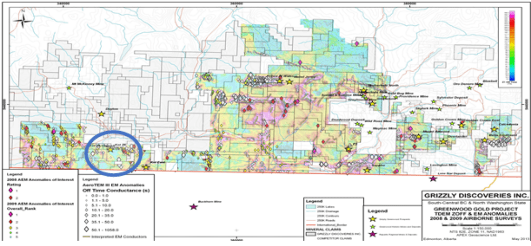
The Ket 28 gold target is located in a road accessible, proven and prolific area, adjacent to the US border in south-central British Columbia, Canada.
Highlights for 2022 soil and rock sampling program at the Ket 28 prospect:
- First significant systematic regional sampling program with more than 1,000 soil samples collected in a 100 m by 200 m grid pattern and analyzed for gold and multi-elements using a partial extraction ionic leach method at ALS Global in Vancouver, BC
- New anomalous gold zones in soils identified immediately southwest of the main Ket 28 showing along with at least four new areas of anomalous gold in soils identified in an area that is about 2.5 km south of Ket 28 and is over 5 km in length and roughly 1.2 km wide up against the US border
- A total of 129 rock grab samples collected across the Ket 28 area with up to 1.5 g/t gold from a sample within the southern anomalous gold in soil area
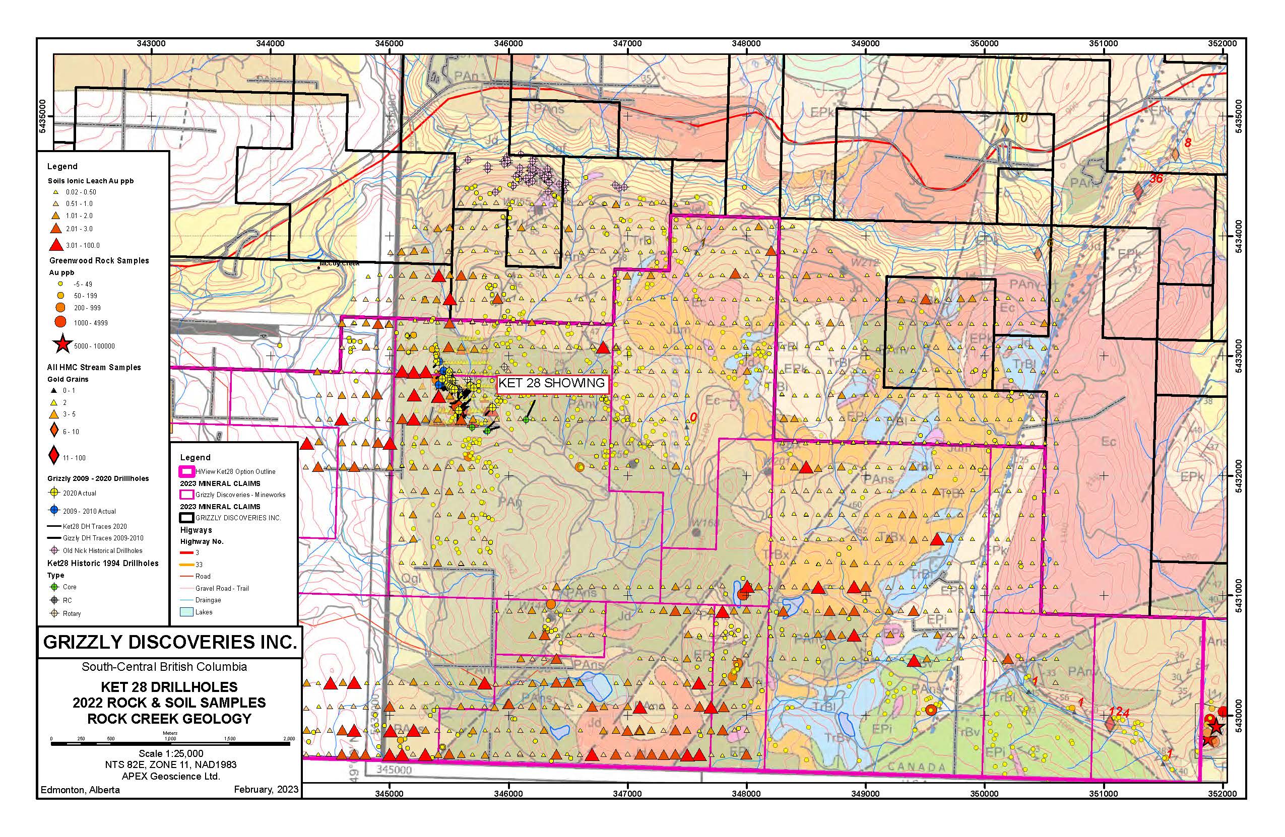
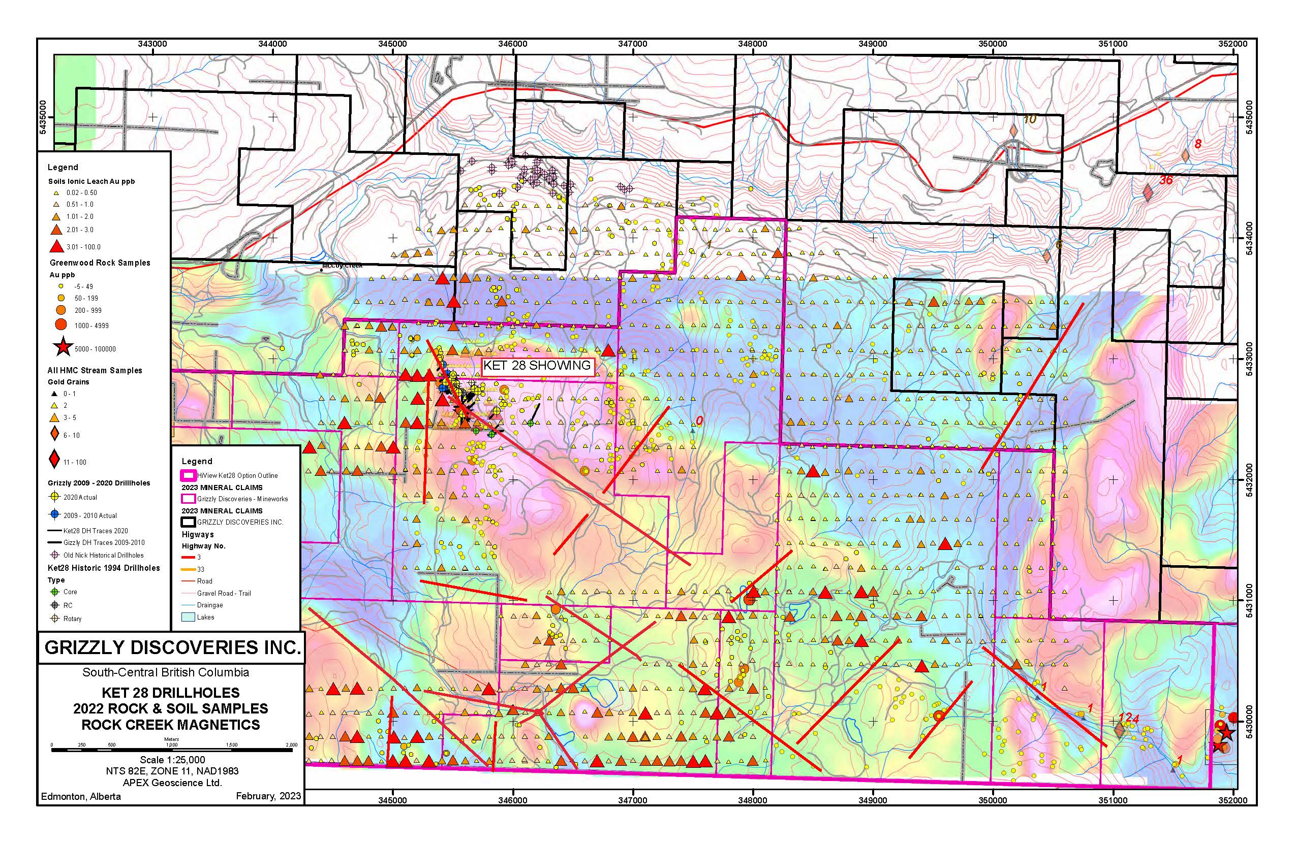
- Numerous northwest and northeast controlling structures within Paleozoic Anarchist volcanic (green) clastic and calcareous sedimentary rocks (orange and blue) along with a number of small to large sized Cretaceous to Eocene (pink) intermediate to felsic intrustions are visible in outcrop and in the geophysics
Ket 28 Drillholes, 2022 Rock & Soil Samples, Rock Creek Geology
Ket 28 Drillholes, 2022 Rock & Soil Samples, Rock Creek Magnetics
2020 Drill Program Gold Target Highlights:
- Results from the last nine holes intersecting broad, near surface gold mineralization. Key intervals include 0.92 grams per tonne (g/t) gold (Au) over 14 m from 27 m including 4.53 g/t Au over 2 m, (20KT14) and 0.48 g/t Au over 11.84 m from 20.16 m) including 3.6 g/t Au over 1 m from 20.16 m (20KT13) (Table 1).
- Results from the first six holes intersecting broad, near surface gold mineralization. Key intervals include 1.59 g/t Au over 17.8 m from 43 m including 7.37 g/t Au over 3.08 m, (20KT02) and 0.77 g/t Au over 31 m from 54.5 m) including 1.42 g/t Au over 11.5 m from 61 m (20KT04) (Table 1).
- The Ket 28 Target remains open with multiple zones to below a 125 metre vertical depth towards an underlying and potentially larger porphyry type feature represented by a large 1 km by 2 km geophysical anomaly;
- All drill-holes intersected variable amounts of sericite-pyrite alteration with quartz veins and silicification hosted in a sedimentary schist, mafic volcanic to basalt package of rocks;
- Drilling has expanded the volume and extent of gold mineralization at surface and to depth, with a strike length of greater than 500 m, a width of about 100 m and multiple near flat lying zones intersected from surface up to a depth 125 m depth
- Diamond drill program consisted of 1,975m in 15 drill holes
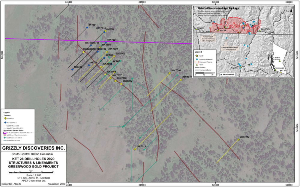
Ket 28 2020 Drill Hole Locations
The Company conducted an exploration program in 2009-2010 consisting of rock and HMC sampling, ground geophysics, and a nine diamond drill hole program. Rock samples near the Ket 28 prospect in the Rock Creek Block yielded assays up to 53.2 g/t Au. A ground magnetics and horizontal-loop electromagnetic (“HLEM”) survey was completed over the Ket 28 prospect and indicated the presence of a northwest oriented structure and a large magnetic anomaly of which the Northwest edge is associated with Au mineralization. Drilling at the Ket 28 target indicates the presence of wide zones of hydrothermal Au-Silver (“Ag”) associated with extensive alteration along a northwest structure. The best drill intersections obtained during the Company’s exploration work are 11.9 g/t Au across 2.0 m core length and 8.85 g/t Au across 3.0 m core length.
Planned exploration for the Ket 28 includes a program of up to 11 drill holes, with the focus to develop a maiden resource.